Fire Tower Lookouts of the Okanogan | OutdoorsNW
 Goat Peak: Christine Estrada
Plan Your Next Hiking Adventure!
The stark beauty and sweeping views that can be seen from a fire lookout tower are beyond compare. Largely built in the early 1900s, fire lookout towers were placed on peaks high enough to afford clear views of the surrounding mountains and valleys, and the lookouts would scan for lightning strikes, smoke plumes, and any other indications of a possible fire.
Today, some of these lookouts are still standing, and Okanogan County is home to the most lookouts remaining today in Washington state, and many of them are a great hike to take on your next vacation. Discover the way fire shapes the landscape and visit these fire lookouts on your next adventure to Okanogan Country!

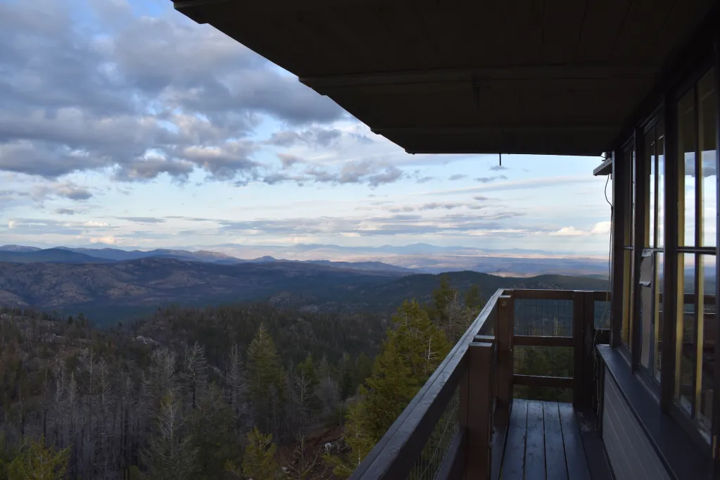
GOAT PEAK
Well-known as one of the most prominent landmarks in the Methow Valley, Goat Peak was regularly staffed until 2015 and occasionally in times of emergency afterward. It was wrapped for its safety in 2017 & 2021, with those season’s fires getting a little too close for comfort!
A great hike in spring, summer, or fall, this 3.5-mile trip is worth the dazzling scenery and incredible views from the top! The first half mile starts off relatively easy, with the elevation gains over a series of switchbacks in the next 3 miles.


MOUNT LEECHER
Mount Leecher (or Leecher Mt) is home to a one-hundred-year-old tree top crow's nest! It’s also well known for its lookout staffer, “Lighting Bill” Austin, who spent 19 seasons at Goat Peak before moving to Leecher in 2014. Narrowly escaping the Carlton Complex Fire of 2014, this current structure was moved from Chiliwist Butte in 1954 and restored in 2009.
From the gate, it is a pleasant 1-mile walk without much elevation gain. “The walk to the summit is classic Okanogan, with big views, blue skies, ponderosa pine, douglas fir, and dry grass & shrub,” says Christine Estrada (“Where in the Wild is Chris?”). Though the lookout is locked when not staffed, you can climb up and soak up the sweeping views of the Methow Valley from just below the cab - or visit while “Lightning Bill” is on duty!

All Above Photos Courtesy: Christine Estrada "Where in the Wild is Chris?"

Photo Courtesy: Bri Sullivan
It's not all rigorous hiking! We are fortunate enough to have two cabs on ground level for EASY ACCESS in Okanogan Country:
Franson Cab @ Molson Museum
The Franson Peak Lookout location is in our neighboring Ferry county. The drive is possible with a 4x4 vehicle - but there is an easier way to see one of the older cabs! When the current structure was built in 1986, the 1950s cab was relocated to the Molson Museum. This easy drive in the Okanogan Highlands lands you in the remote ghost town of Molson east of Oroville, complete with indoor & outdoor museums! Check out the historic cab at ground level, plus explore the history and artifacts of this one-of-a-kind region.
"Solitude" 1930s Replica Cab @ TwispWorks
Although a replica of a 1930s cab - this sweetheart is located in the TwispWorks native plant garden and is very accessible! Built using reclaimed materials in 2014, Tori Karpenko assembled it for a Traver Gallery art show and then again for an exhibit at the old Burke Museum. It was then purchased by a private party and donated to TwispWorks for permanent installation in 2018. It can now be enjoyed from the ADA-accessible pathways through the Methow Valley Interpretive Garden or three steps to bring you inside the Lookout cabin. Be sure to check out the 1939 Fire Warehouse windows that were sourced from the TwispWorks campus!
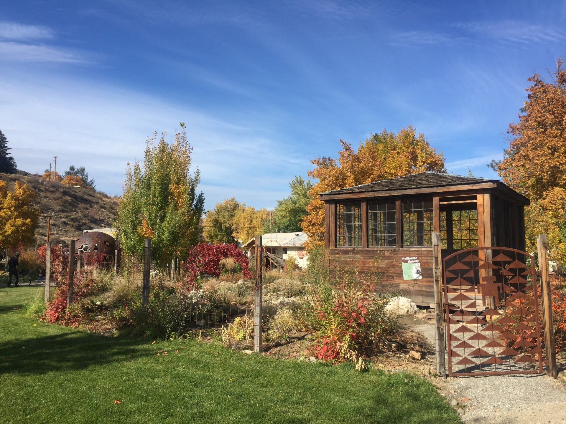
Photo Courtesy: TwispWorks
Want to read the rest of our article in OutdoorsNW Magazine? Click Below!

Mount Bonaparte: Christine Estrada
fire shaped landscape map

See how the fire shapes our landscape! A mosaic with new layers each season, the Okanogan Country is always changing. Pre-order your physical copy of the Fire Shaped Landscape Map, or download a digital copy today!